Tense on the Fence – Ladakh
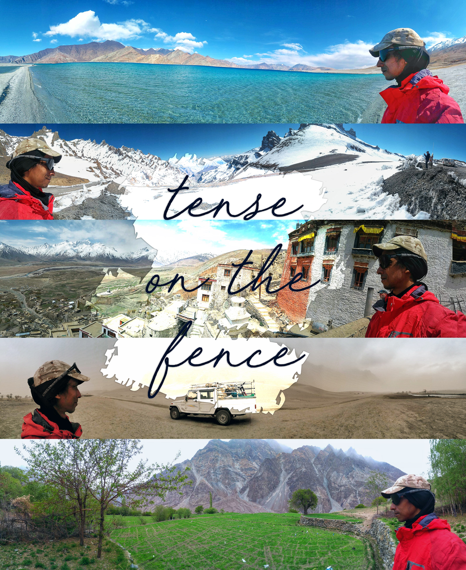
Who’s in control of a hill? Is it the weapon or the one handling the weapon? May be it’s both, the mountain bike set-up right and the rider pointing it down the trail. On this journey we set out to the hills that sit close on the Line of Control (LOC), the terrain that’s on the fence between India and Pakistan and also China.
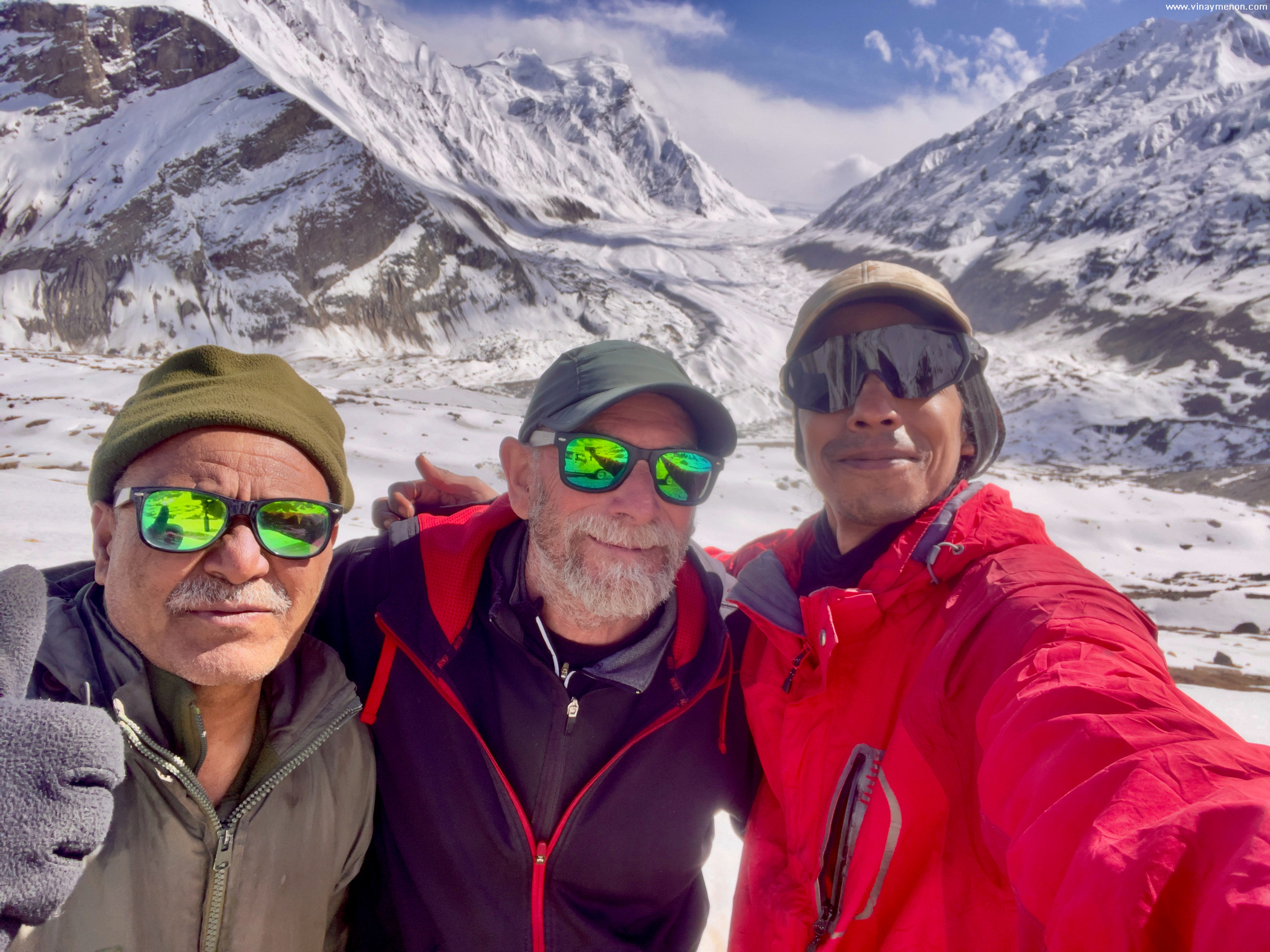
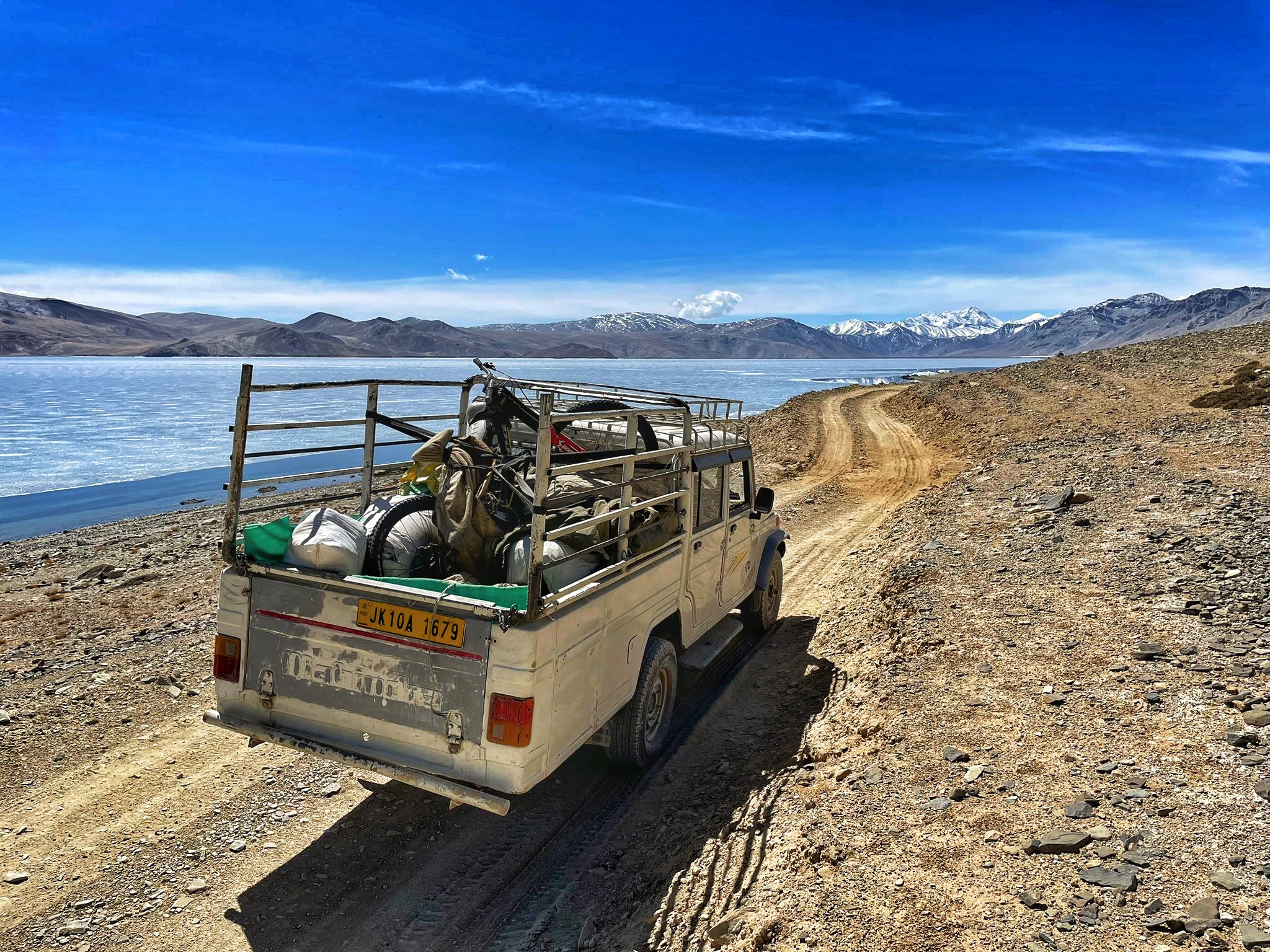
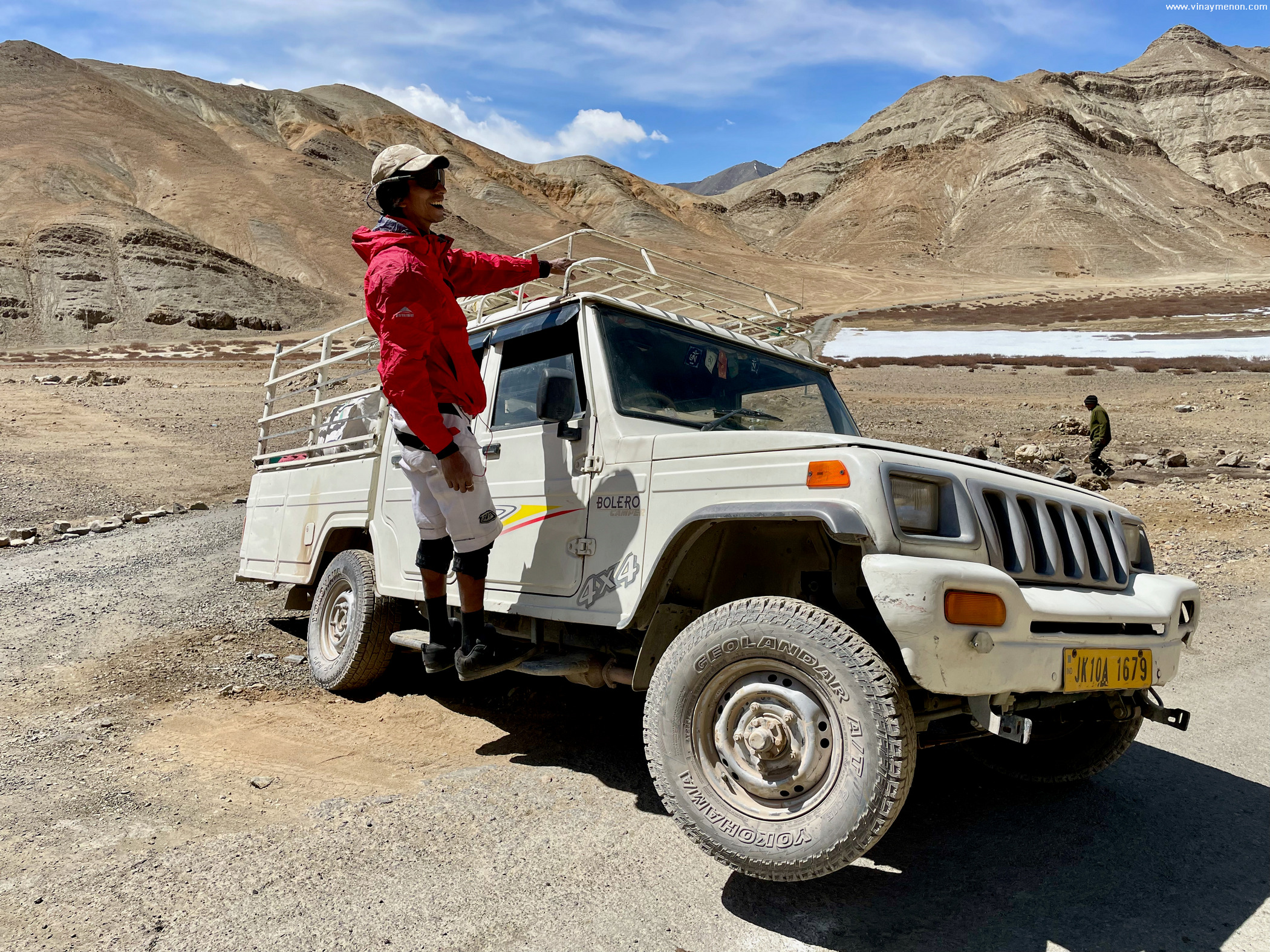
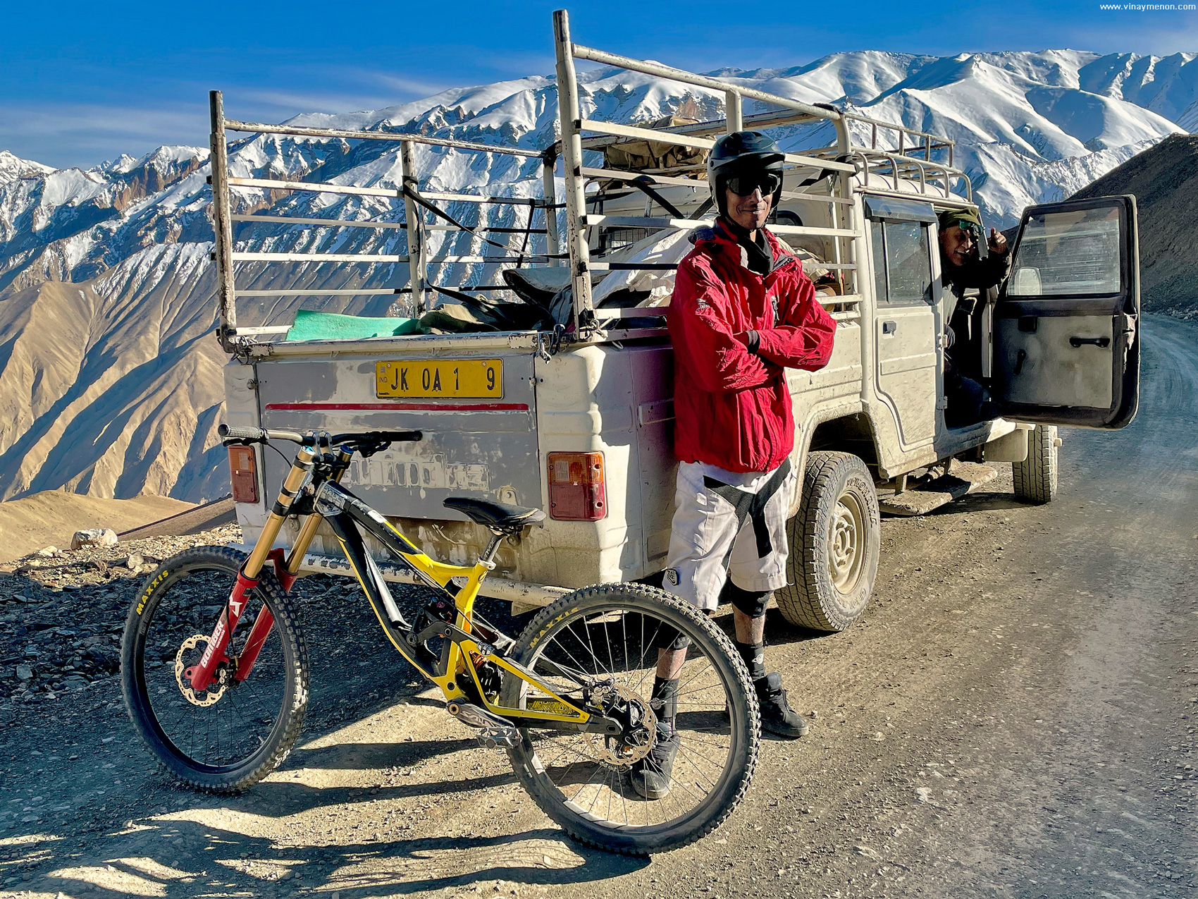
After weeks of thought, the plan finally got us booking flight tickets and packing our supplies for the terrain hunt. This one, in Ladakh’s remote corners with ace photographer and good friend Malcolm McLaws from Canada. Joining us on this adventure was another friend of mine, Stanzin Namgyal. A Ladakhi local with dense knowledge of the remote terrain that we eyed, along with hilarious stories to share through our drive in his 4×4 pickup truck.
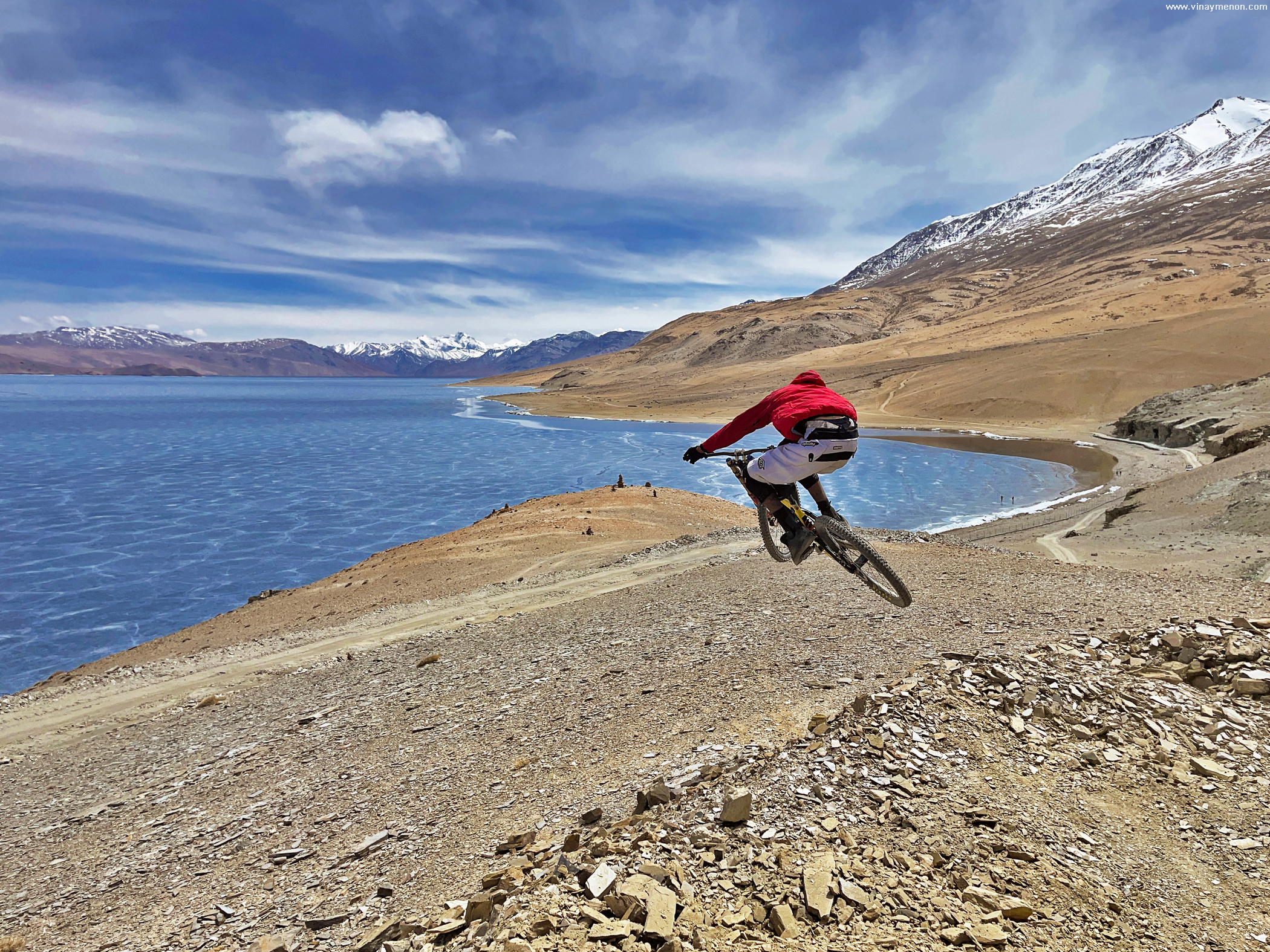
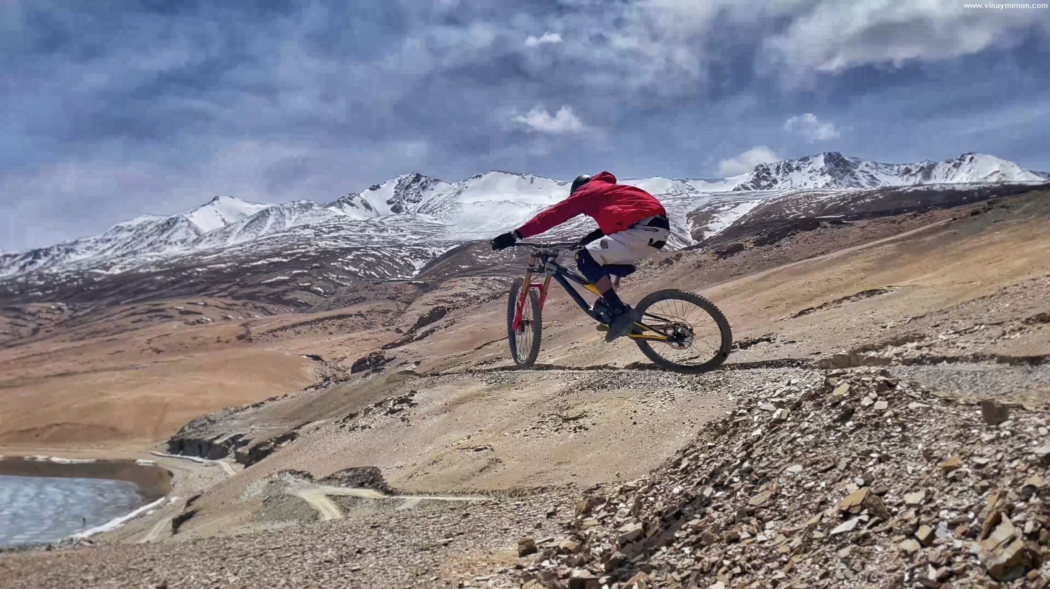
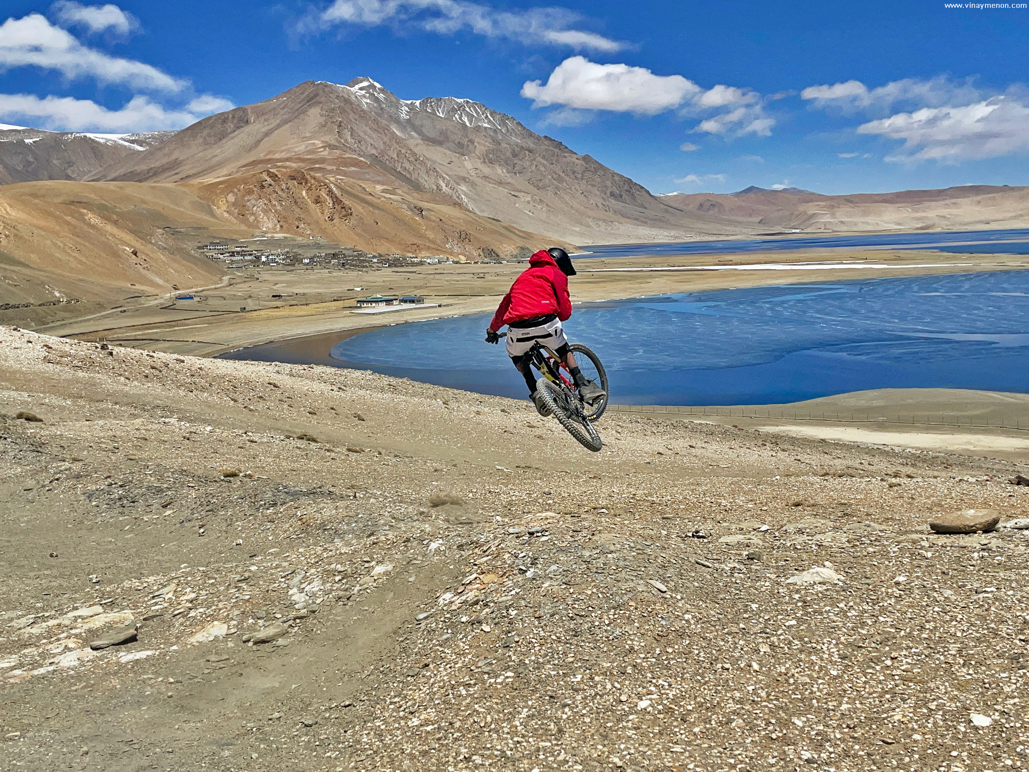
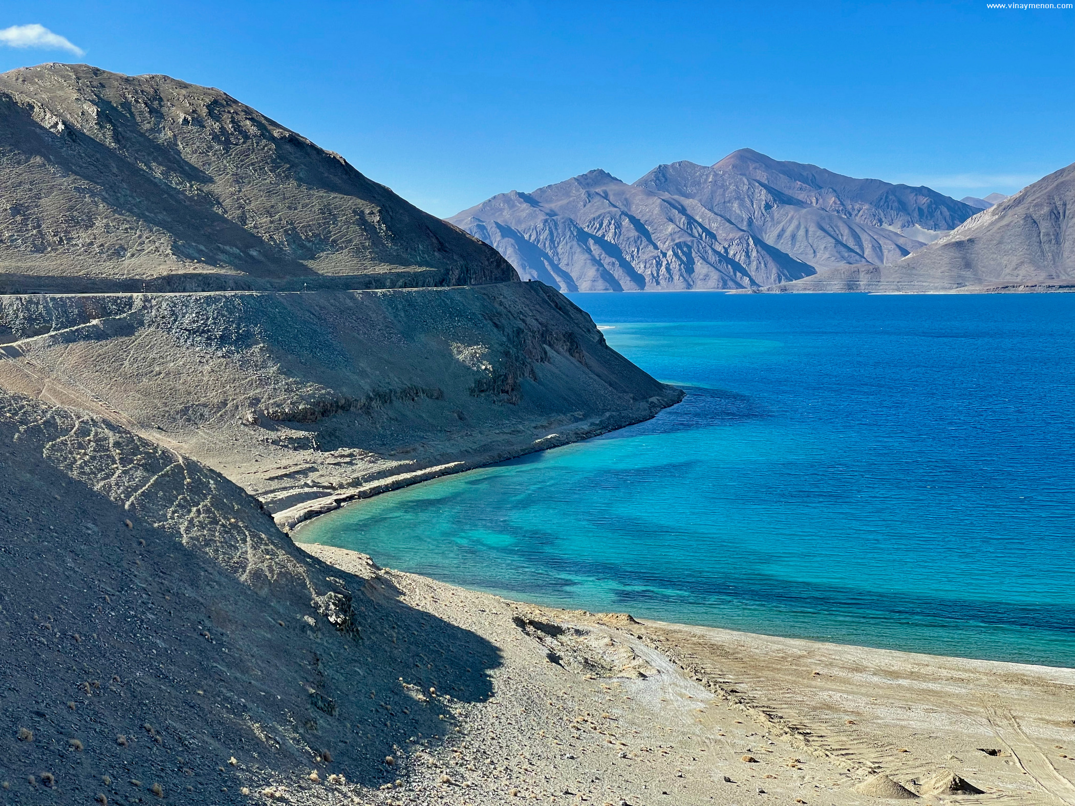
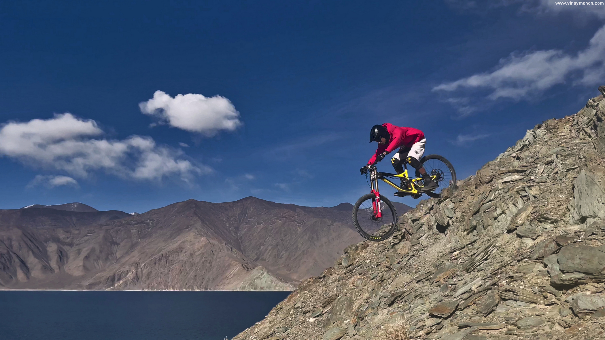

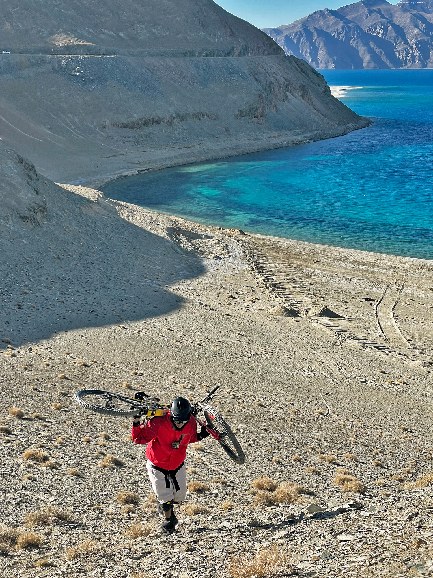
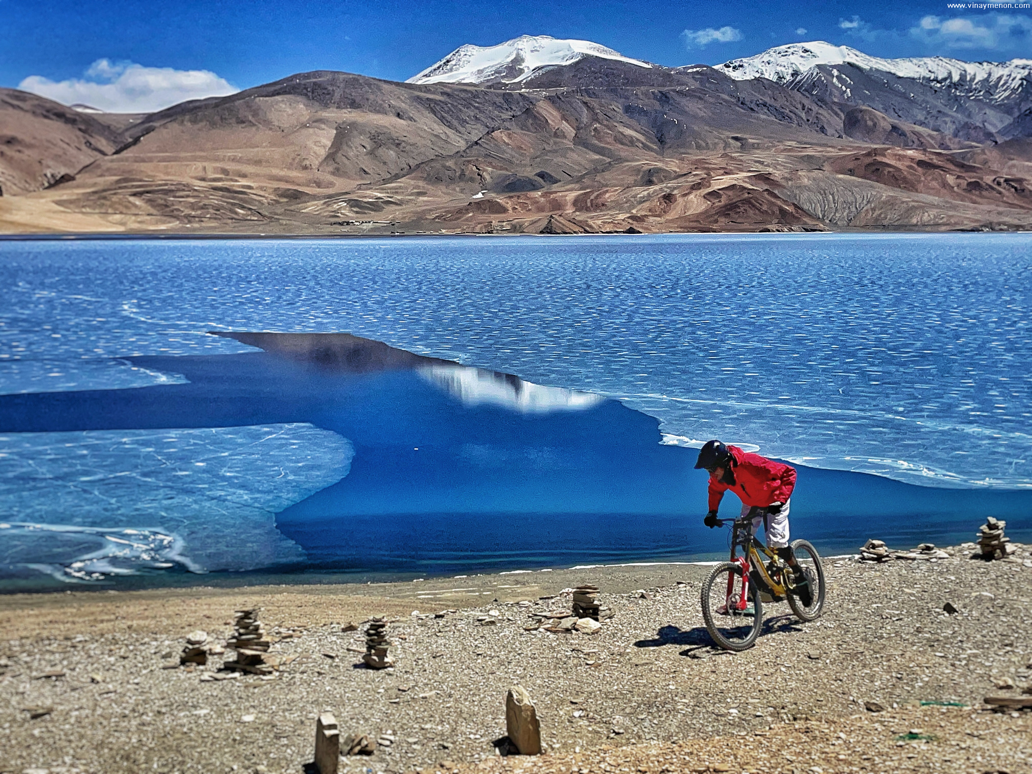
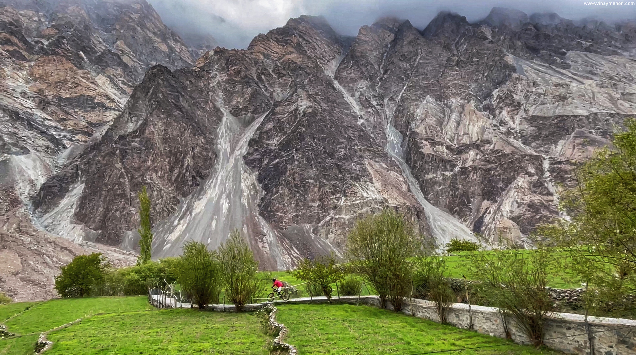
Our drive took us through the winding Himalayan roads made by BRO (Border Roads Organisation) through Tso Moriri and Pangong Tso. Pangong lake shares a major portion with China. On land or on water, international fences run deep! After playing in extremely high winds on rock chips and jagged rock descents, we made our way into Nubra Valley. From dry and deserted mountainscape to the contrasting green valley views. Our base for the next few days, Stanzin’s family home in Diskit, a beautiful little village-town in the Nubra Valley.
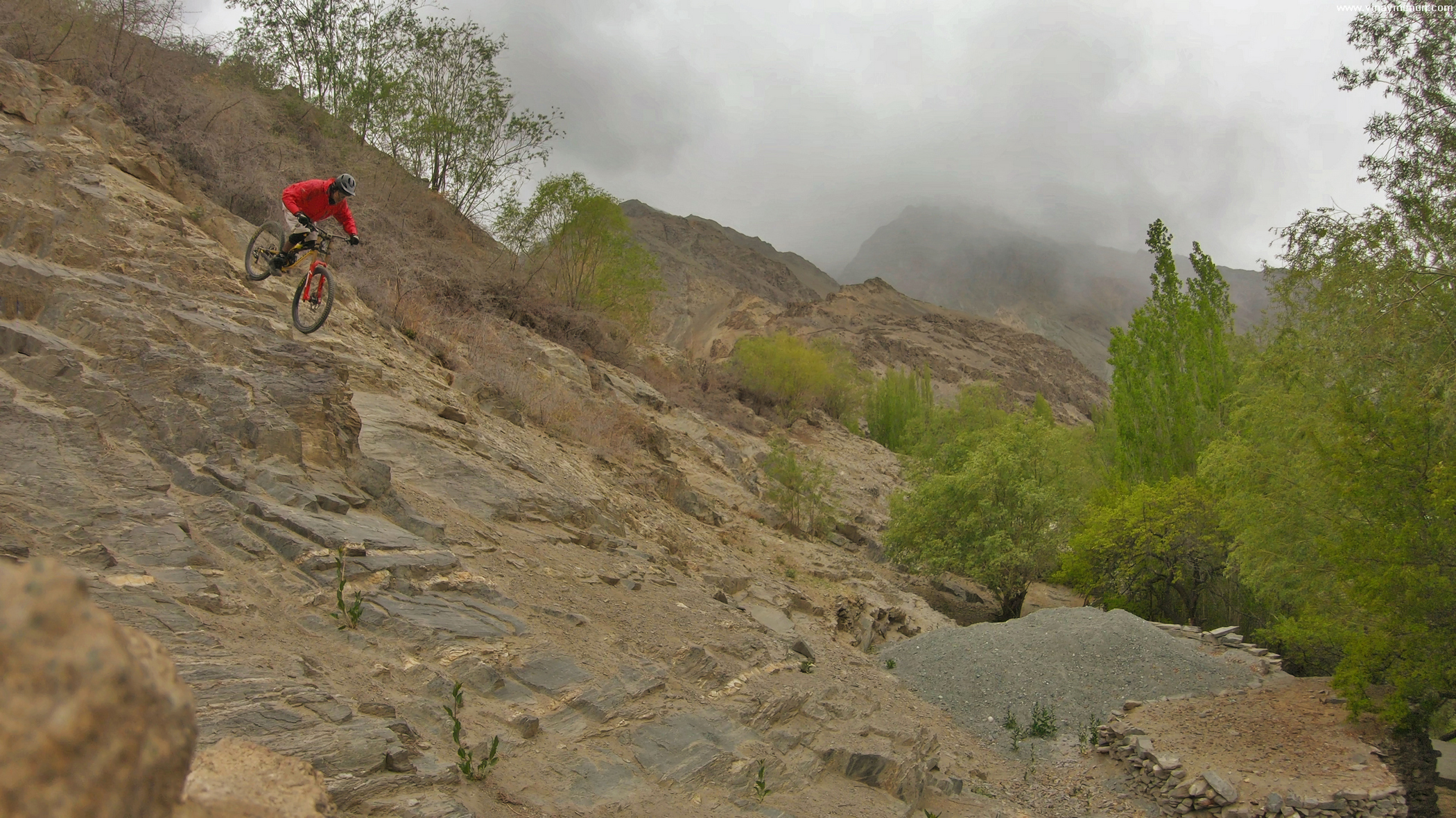
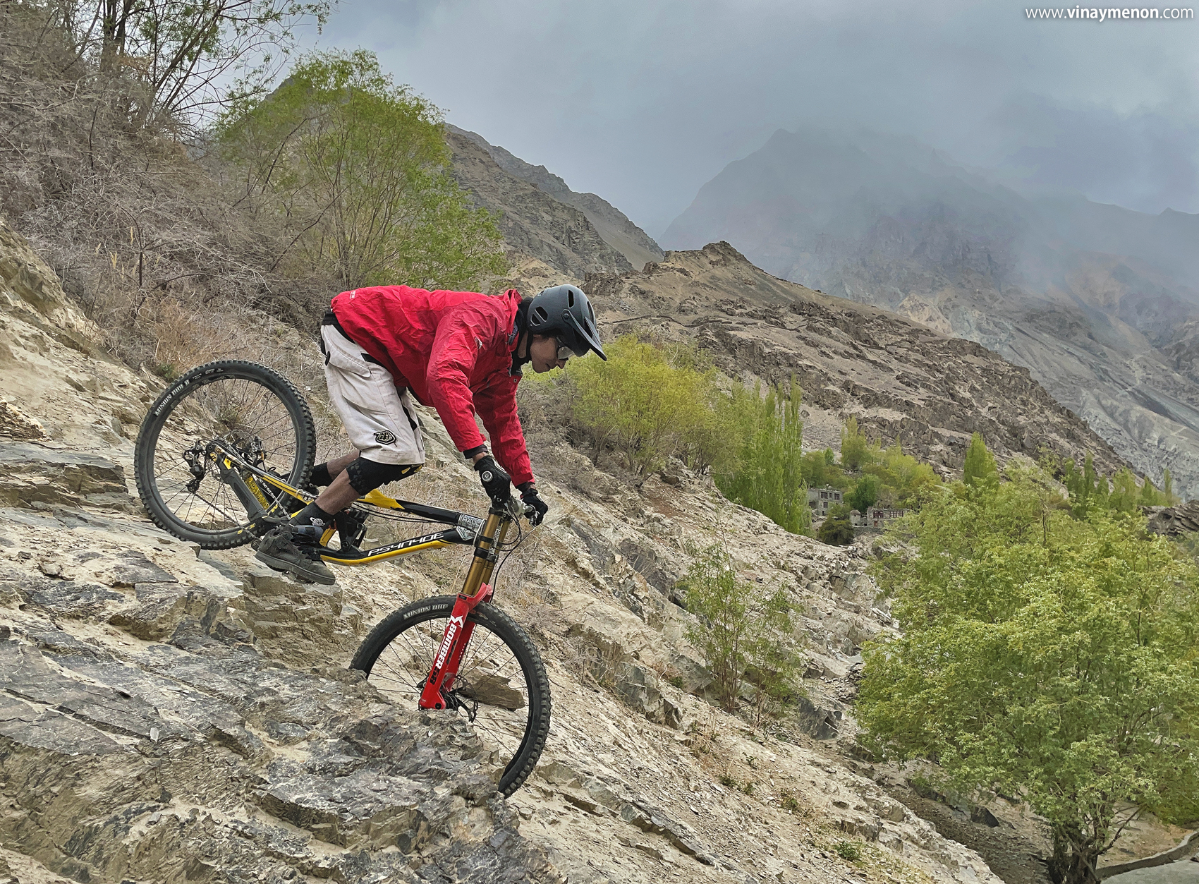
Our next phase of the journey was through the valley towards Turtuk. Also known as the last village of India, Tyakshi village was set as our point of return. A village that shares borders with our neighbour – Pakistan, Tyakshi village is inhabited by the Balti community. Amidst the lush green farm lands and dense forest, the rocky mountain peaks caught our sight. The mountain that was just across the fence in Pakistan. A closer look at the approach trail that lead to those hills, a small board in the woods that read “Warning – This area has landmines”. We’d reached the fence. A fence which subtly poked us to turn back, to accept that fences are meant to keep the land maps in control.

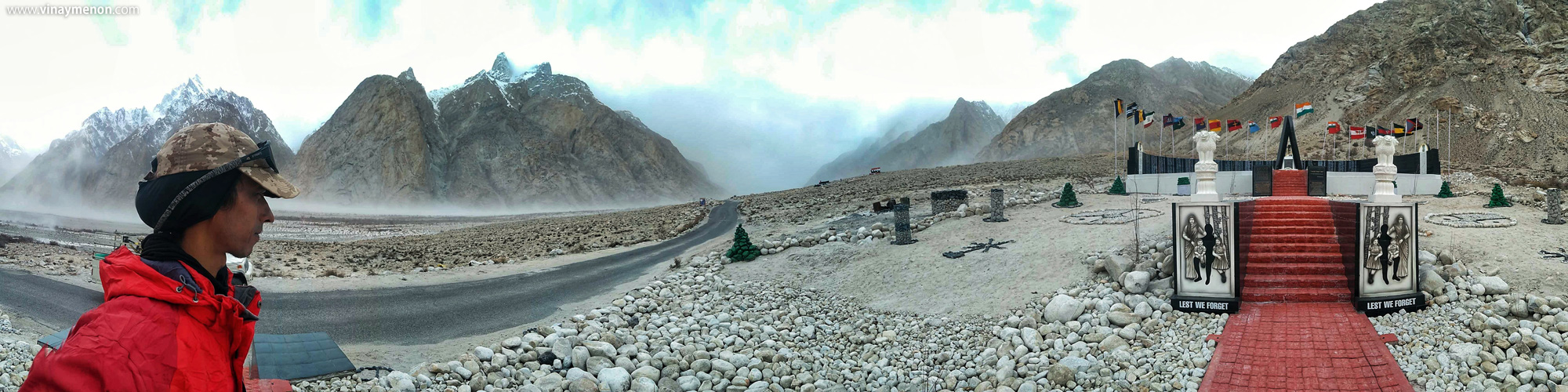
After a night back in Diskit we drove towards Siachen base that has only recently been opened for civilians. India and China have had friction over these mountains in the past. Now, with peace in the sky (or so we feel) thanks to the Indian armed forces, recreation seekers like us get the opportunity to see, ride some of these hills.
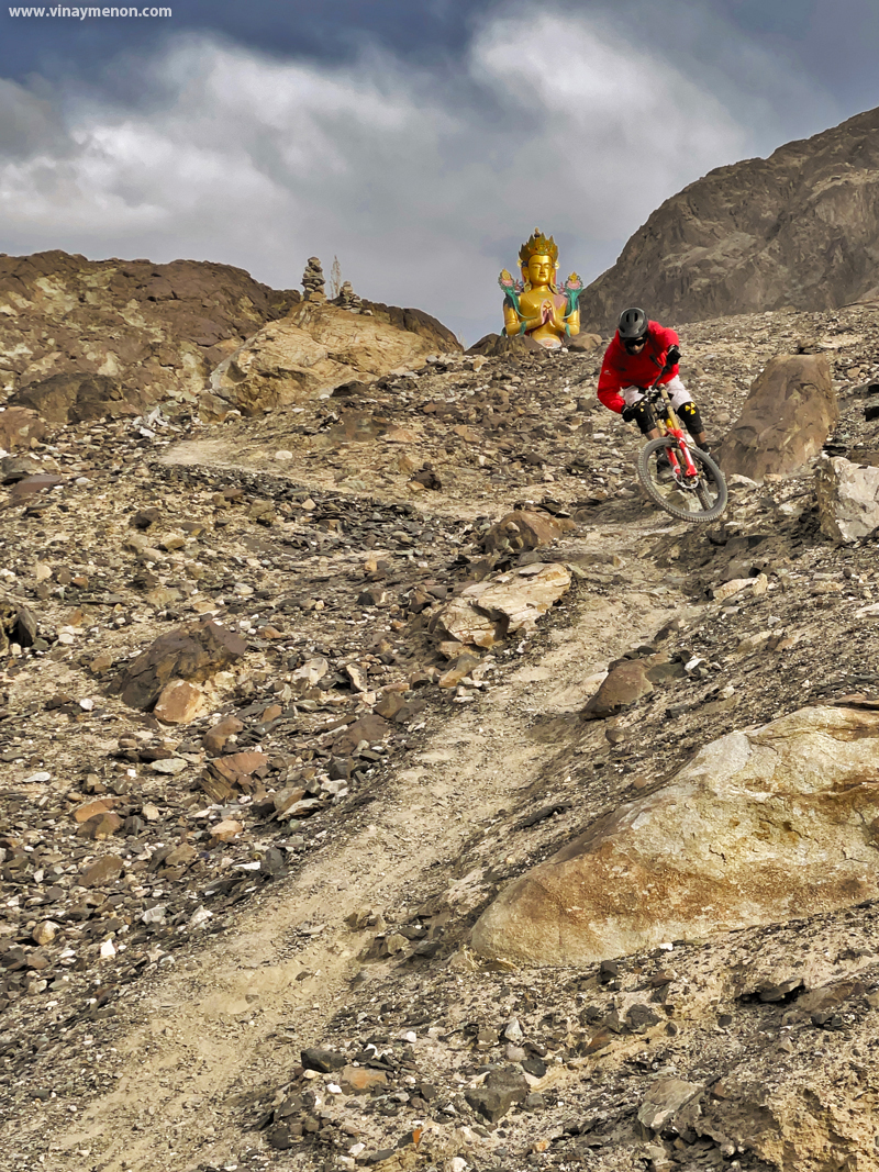
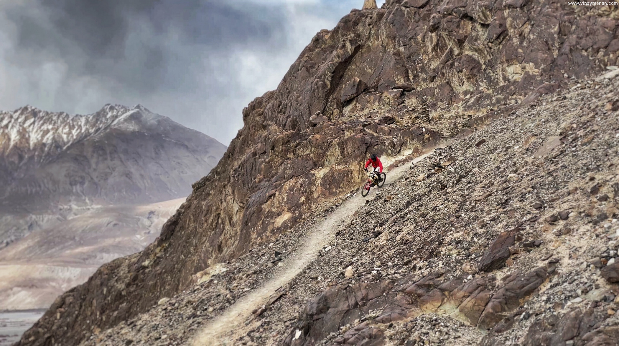
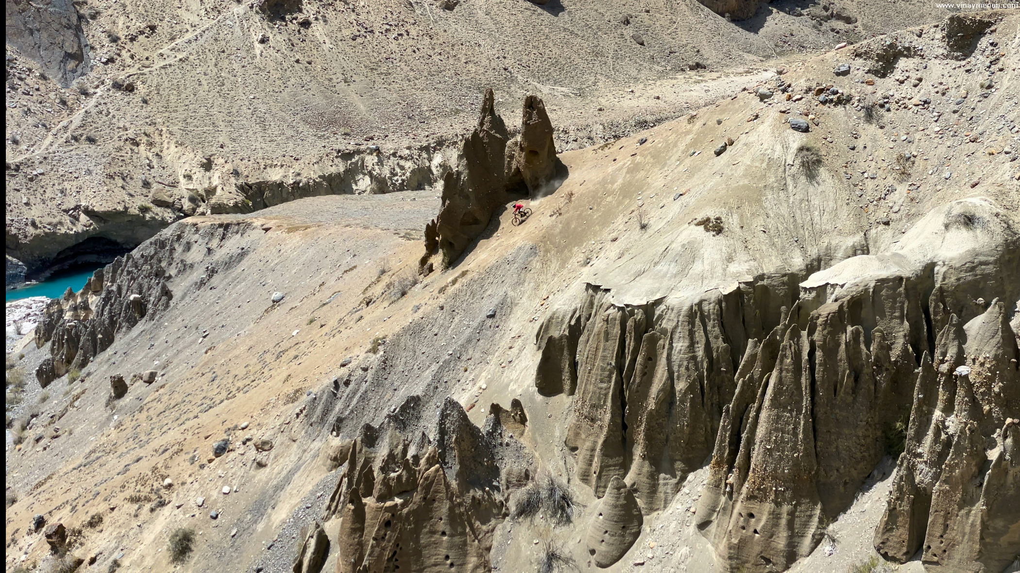
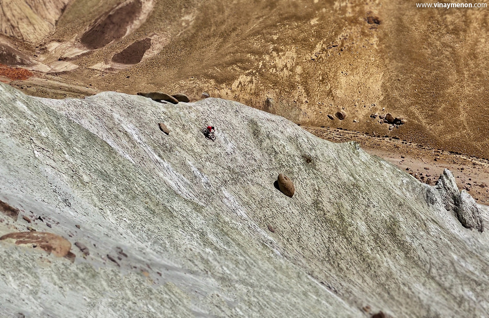
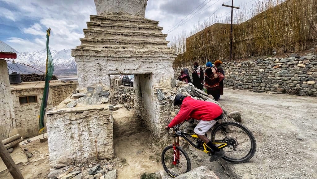
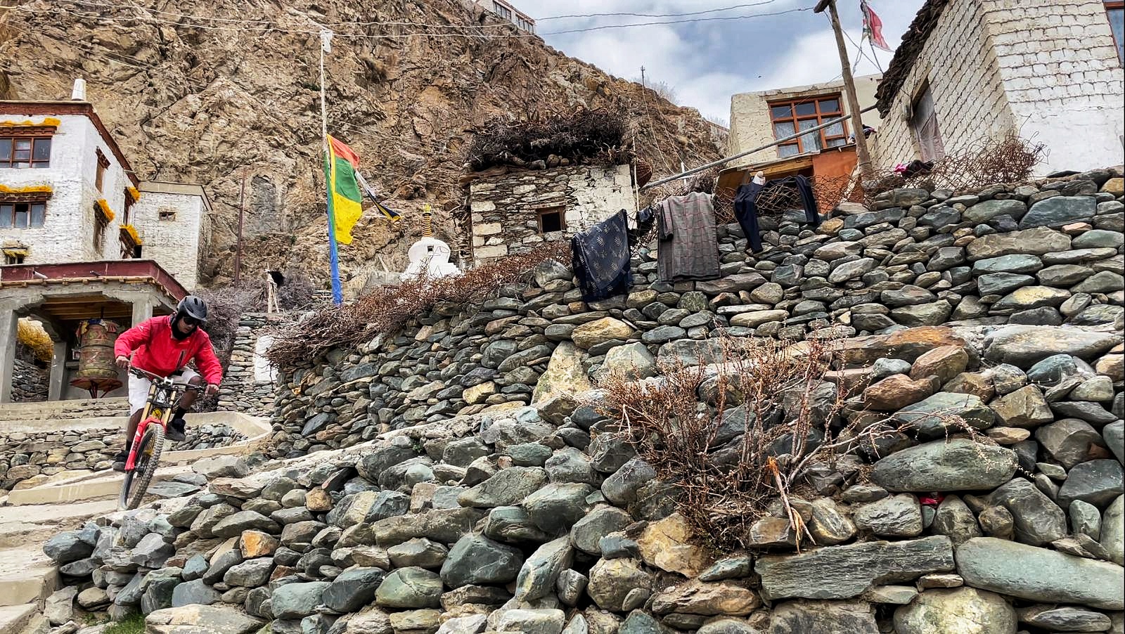
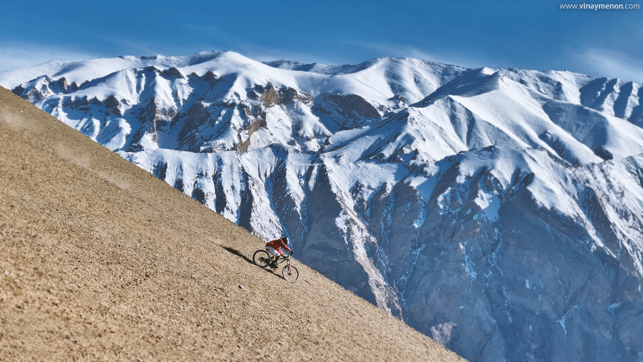
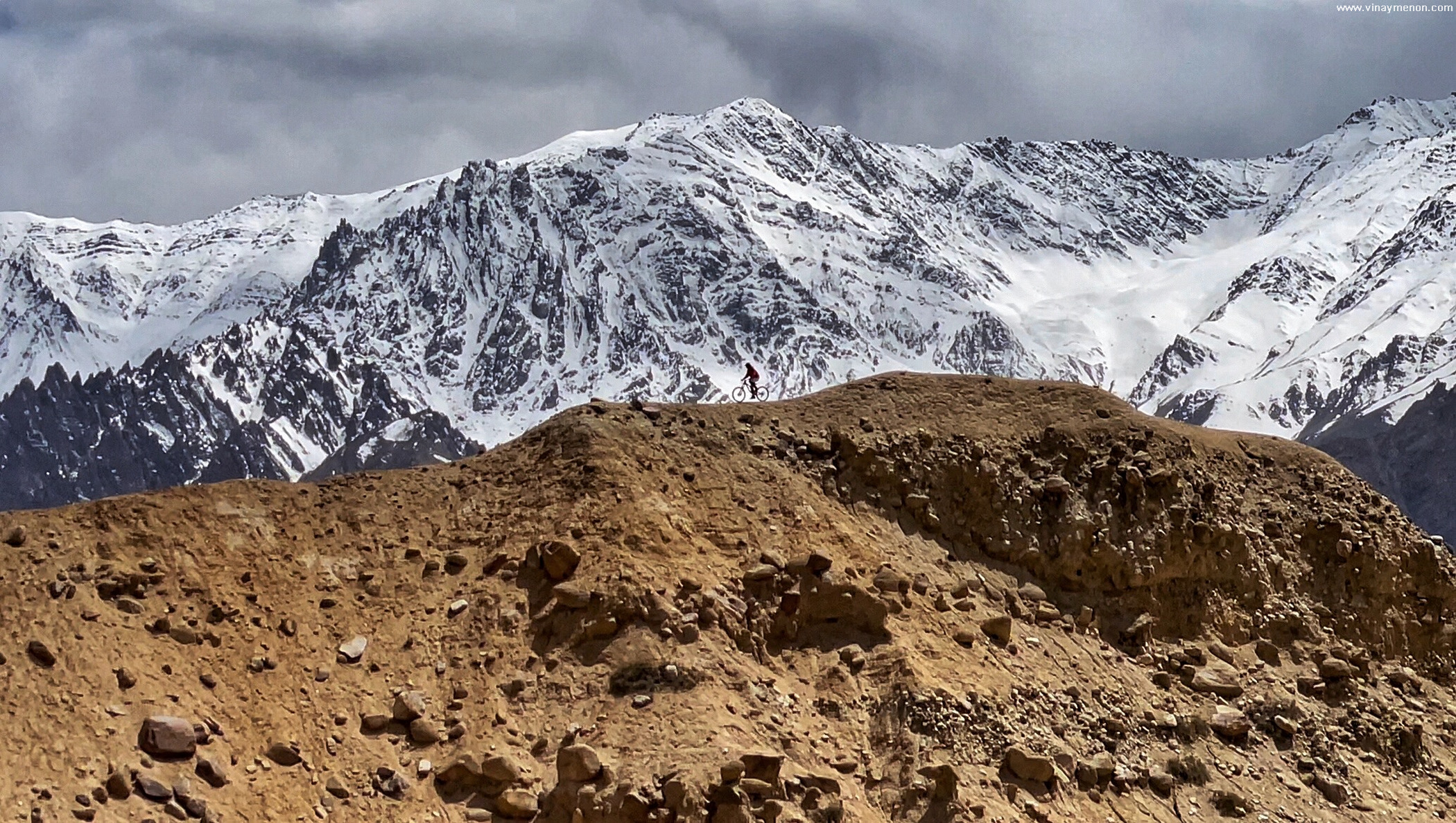
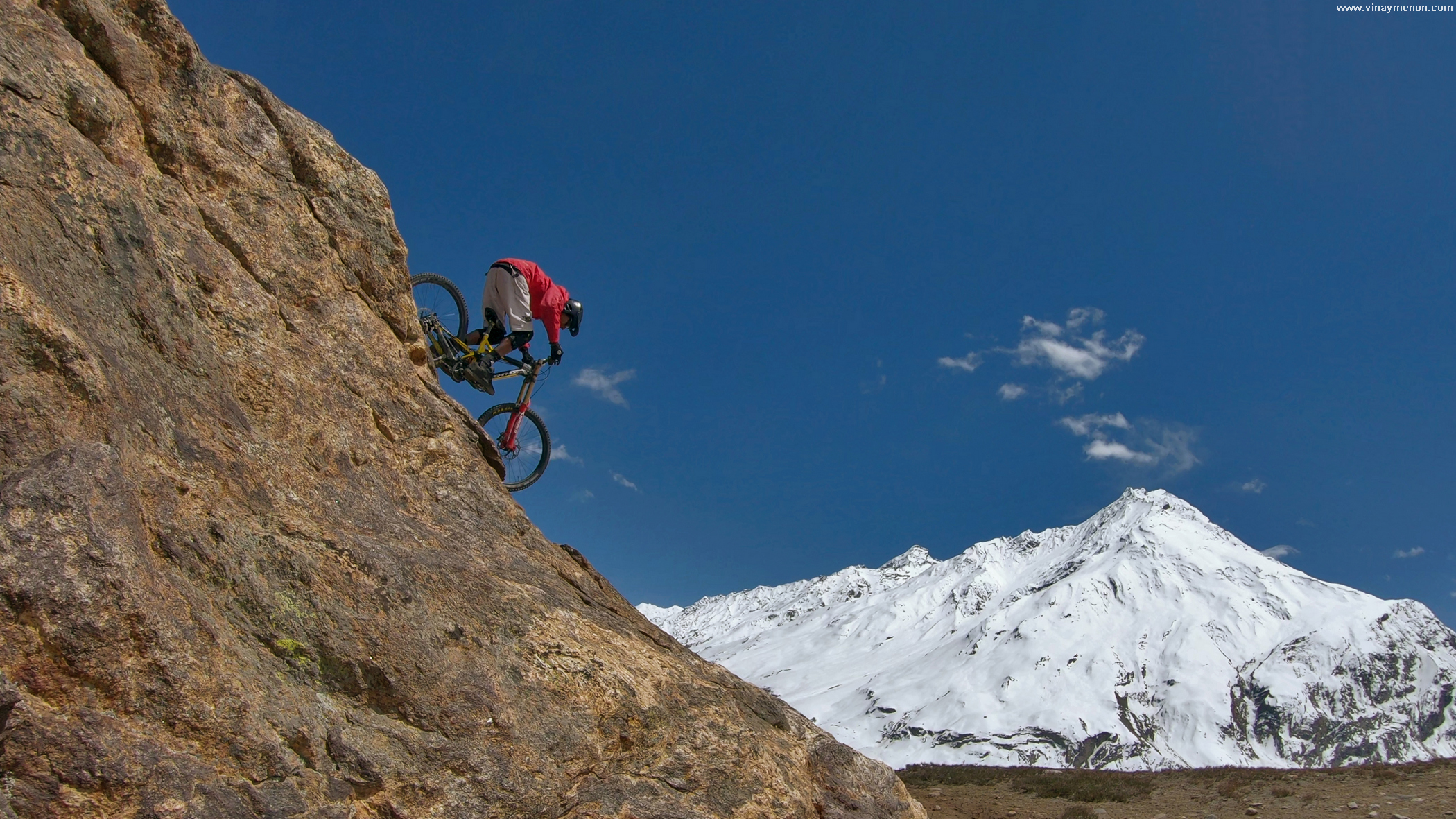
Dodging sandstorms and high altitude snowfalls we made our way back to Leh city, our base for the week. After restocking our supplies, picking up cash, doing our laundry we got ourselves ready for the next leg of the hunt – Zanskar valley. The jagged rocks, towering mountains on both sides of the under-construction road made us hungry for lines in this intense landscape. Lines that weren’t far from our sight (or so we thought). It’s one thing seeing a descent from afar and another when we actually start hiking up that hill. In 40 degree Celsius afternoon sun I creeped up the hills I spotted from our truck while Malcolm shot with his new phone and Stanzin waited for us at the bottom of the hill. Playing in the hills or guarding the front lines, it requires a team. Each sharing their expertise to bring along one common goal.

Weather in the Himalayas is often unpredictable. We faced that the next morning on our drive through the Zanskar region. As the extreme weather threw a fence on our plans of driving into Himachal Pradesh, we opted to drive back through Padum and onwards to Kargil over the next few days.

The landscape changed from monasteries in rocky mountains to farm lands and little villages, we were approaching the National Highway number one. Back into the highway traffic towards Srinagar in Kashmir.
With our memory cards full of magnificent views of the Zanskar and my bike’s brake-pads still warm from the descents, we made our way to Srinagar city to repack and set out to go our directions. Unfenced and unpaved paths ahead, un-tensed to ride free.